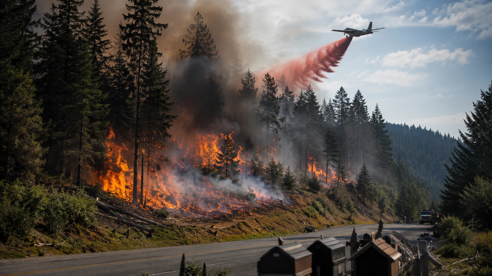

Evacuations downgraded to Level 1. The Hidden Meadows Fire ignited around 11 a.m. on Monday, August 24, 2026, west of State Route 503 between Hidden Meadows Drive and Mountain View Drive, in rural Clark County, Washington, near Yacolt and Battle Ground. The fire grew quickly to an estimated 12 acres and triggered Level 3 "GO NOW" evacuation orders for roughly 250 homes at its peak, with a total of 805 homes under some level of evacuation notice. By Monday evening, crews had built a containment line around the fire and evacuation levels were downgraded to Level 1 "Be Ready." State Route 503 has since reopened in both directions between Northeast Gabriel Road and Northeast 365th Street. No houses had burned and no injuries were reported. The cause remains under investigation.
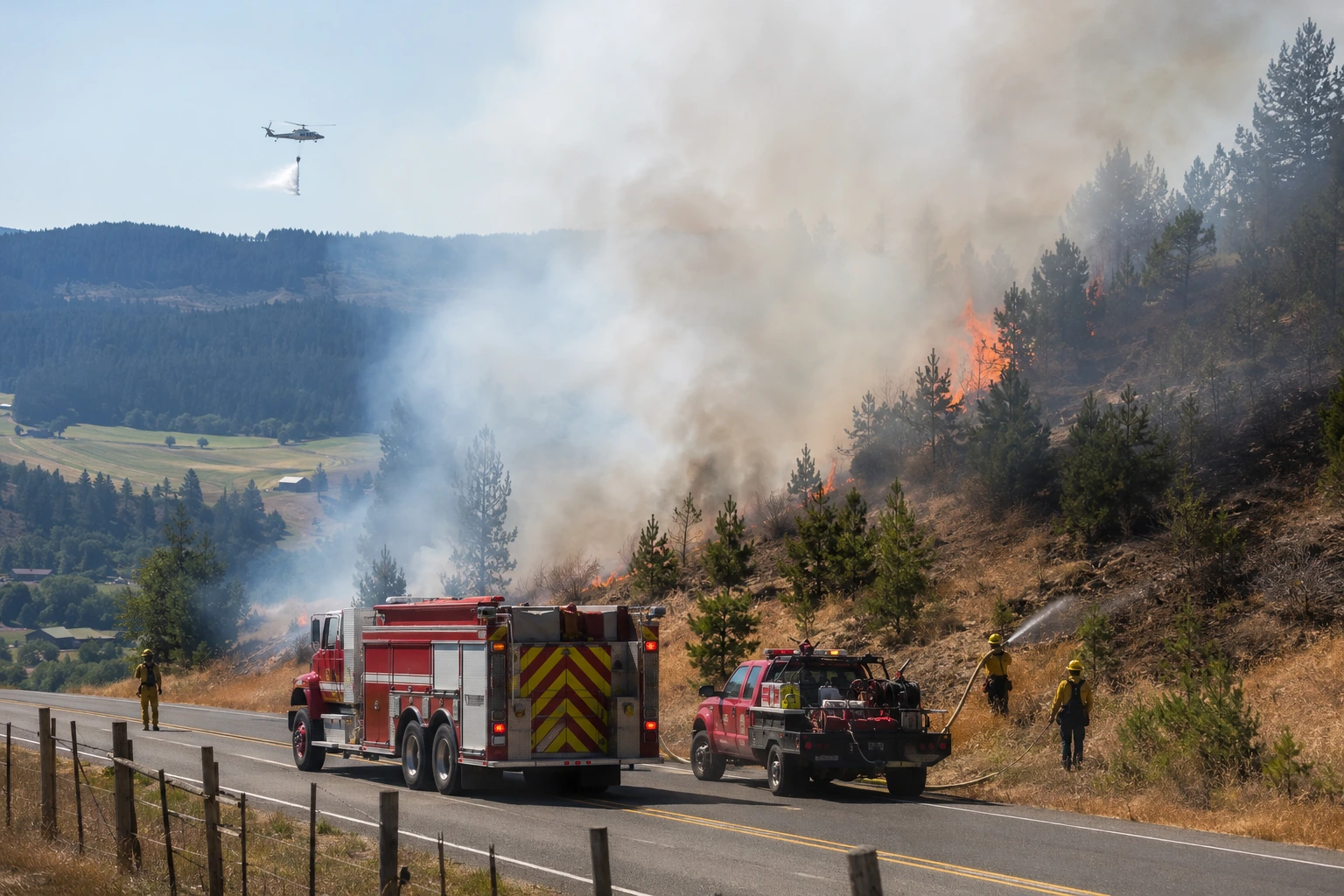
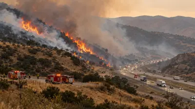
Residents near Yacolt reported a large column of smoke, the crackle of flames, and falling ash shortly before 11 a.m. Monday, prompting a rapid response from Clark-Cowlitz Fire Rescue, Clark County Fire District 10, and the Washington State Department of Natural Resources. Within hours, DNR aircraft were dropping retardant on the fire as ground crews built a bulldozer line around its perimeter.
Evacuation Levels and Road Closures
At the fire's peak Monday afternoon, the Clark Regional Emergency Services Agency (CRESA) ordered a Level 3 "GO NOW" evacuation for about 250 homes in a zone bounded by Northeast 359th Street to the north, Northeast 329th Street to the south, Rock Creek to the east, and 116th Avenue to the west — telling residents "leave immediately, failure to act now may result in injury or death." Another 210 homes were placed under a Level 2 "Be Set" order and 345 under a Level 1 "Be Ready" notice, for a combined 805 homes affected. The Clark County Sheriff's Office conducted door-to-door evacuations and traffic control in the zone. By Monday evening, as crews gained the upper hand, officials downgraded the entire area to Level 1 "Be Ready." State Route 503, which had been closed in both directions between Northeast Gabriel Road (milepost 14.1) and Northeast 365th Street (milepost 15.7), has since reopened as fire activity eased.
Who Responded
Clark-Cowlitz Fire Rescue led the response alongside Clark County Fire District 10 and the Washington State Department of Natural Resources, which sent helicopters to support the ground attack. At the height of the response, two helicopters, five water tenders, seven engines, one truck, and twelve squad and brush units were assigned to the fire, along with several chief officers. A DNR spokesperson said crews bulldozed a containment line down to mineral soil around the fire's perimeter — the standard method for stopping a ground fire's advance — and described the fire as largely under control by Monday evening, though an official containment percentage had not yet been released.
Frequently Asked Questions
Where is the Hidden Meadows Fire?
The fire is burning in rural, unincorporated Clark County, Washington, west of State Route 503 between Hidden Meadows Drive and Mountain View Drive, near the towns of Yacolt, Battle Ground, and Fargher Lake.
Is SR-503 open?
Yes. State Route 503 was closed in both directions between Northeast Gabriel Road (MP 14.1) and Northeast 365th Street (MP 15.7) while crews fought the fire, but it has since reopened as fire activity eased and evacuation levels were downgraded.
What evacuation level is the Hidden Meadows Fire area under now?
As of Monday evening, the area was downgraded to Level 1 "Be Ready" after peaking at Level 3 "GO NOW" for about 250 homes earlier in the day. Residents should continue monitoring Clark Public Alerts for changes.
Have any homes been destroyed?
No. Officials reported no homes burned and no injuries as of the latest update.
What caused the Hidden Meadows Fire?
The cause remains under investigation.
Where to Get Live Updates
- Clark Regional Emergency Services Agency (CRESA) — official evacuation zones and Clark Public Alerts sign-up.
- Washington State Department of Natural Resources — fire size and containment updates.
- WSDOT Southwest — SR-503 closure and reopening status.
- Local broadcasters — The Columbian, KATU, KOIN, KPTV, KGW, and OPB provided on-the-ground coverage.
This article will be updated as evacuation levels or containment status change. Verify any update against official Clark County channels before making safety decisions.


Comments 0
No comments yet. Be the first to share your thoughts!
Leave a Comment