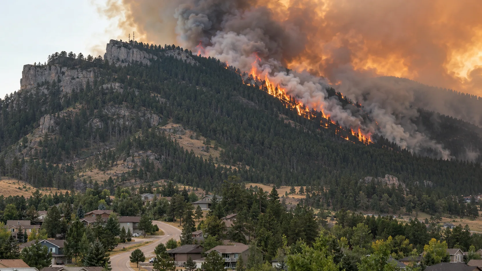

Latest update — September 11: The Lookout Fire near Spearfish remains at 444 acres and has reached 71% containment. Evacuation orders have been lifted and previously closed local roads have reopened. Officials say the fire was human-caused and began when burning hay bales in a roadside ditch ignited surrounding vegetation. Crews continue to secure the perimeter and watch for hot spots as dry, windy weather remains a concern.
The Lookout Fire started Monday, September 7, in the Lookout Mountain area north of Spearfish in Lawrence County, South Dakota. The first public reports placed the fire near the 3500 block of Cactus Place, close to Kerwin Road and east of U.S. Highway 85.
The fire expanded rapidly Monday afternoon and evening, moving from early estimates of roughly 40 acres to about 300 acres by Monday night. A more complete mapping update placed the incident at 444 acres. The footprint has remained essentially unchanged since the initial run, while crews have steadily increased containment around the perimeter.
In this update:
Latest Lookout Fire Status
| Incident | Lookout Fire |
| Started | September 7, 2026 |
| Location | Lookout Mountain / Lookout Peak area near Spearfish, Lawrence County, South Dakota |
| Latest mapped size | 444 acres |
| Containment | 71% |
| Incident management | Type 3 team transitioning to local Type 4 management |
| Fire behavior / progress | Forward progress stopped; crews securing containment lines and checking hot spots |
| Evacuations | Evacuation orders lifted; residents have been allowed to return home |
| Cause | Human-caused; burning hay bales in a roadside ditch |
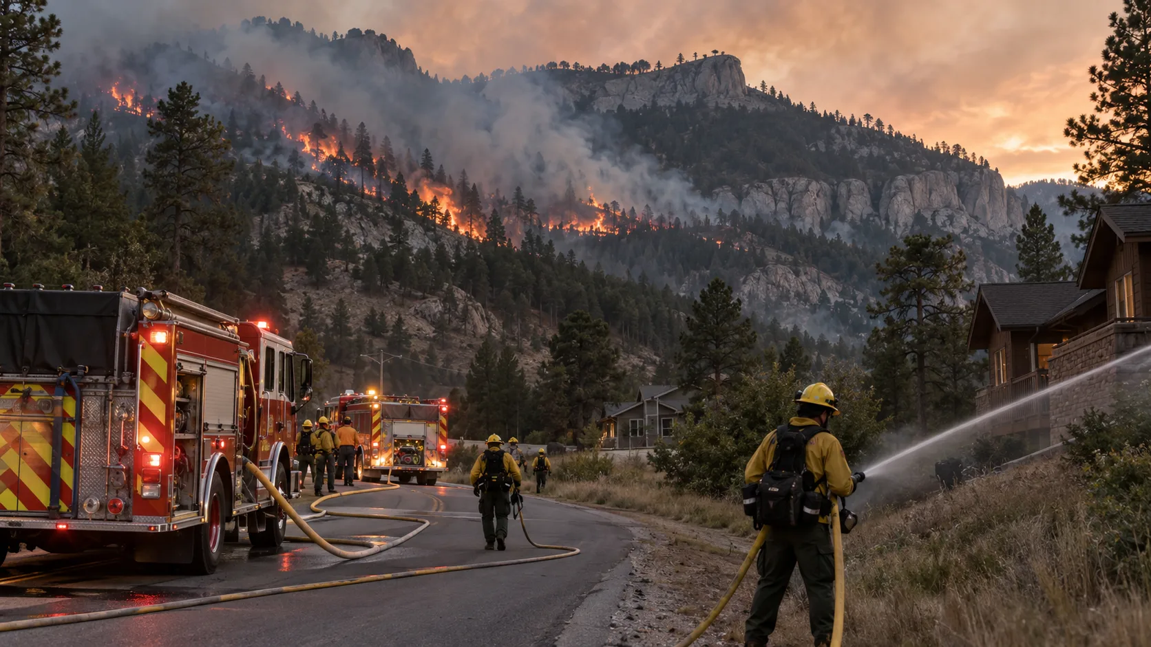
The fire's footprint has changed very little since the first major run, but the amount of secured line around it has increased substantially. Crews have stopped forward progress and are continuing to strengthen line, patrol the perimeter and deal with heat that remains inside the burned area.
Officials reported that all structures threatened by the fire remained standing. The improving containment allowed previously closed local roads to reopen and set the stage for management of the incident to transition from the Type 3 team to a local Type 4 organization.
What 71% containment means: roughly 71% of the fire perimeter has a completed control line that officials believe can reasonably be expected to stop the fire from spreading. It does not mean that 71% of the interior is extinguished; smoke and isolated hot spots can remain well after containment rises.
Lookout Fire Evacuation Status Near Spearfish
Monday's fast-moving fire prompted evacuation alerts around Lookout Mountain, Kerwin Road, Lookout Vista Road and nearby neighborhoods, and law enforcement went door to door in areas that could be threatened.
Evacuation orders have since been lifted, allowing residents in the Lookout Mountain, Kerwin Road, Lookout Vista Road and surrounding areas to return home. Officials also reported that the structures threatened during the fire remained standing.
Evacuation orders are no longer in effect in the latest verified update. Conditions can still change, especially during periods of stronger wind. Residents near the burn area should continue to follow Spearfish and Lawrence County public-safety notices.
Emergency officials have also asked people to use 911 only for emergencies rather than requesting general wildfire information. During the initial response, dispatchers received a heavy volume of fire-information calls while crews were evacuating threatened homes.
Road Closures and Traffic Restrictions
Previously closed local roads reopened as conditions improved. The remaining traffic issue in the latest local update was one northbound lane of Interstate 90 between mile markers 10 and 12, where smoke and suppression activity remained close to the roadway.
Drivers should continue to use caution around the incident, particularly where smoke may reduce visibility. Fire equipment and crews may still be working close to the roadway even as broader access restrictions are removed.
A Temporary Flight Restriction is also in place over the incident. Unauthorized aircraft and drones can force aerial firefighting resources to stop operating, so recreational drone flights should remain well away from the fire.
Where Is the Lookout Fire?
The Lookout Fire is burning north of Spearfish in the northern Black Hills, around the Lookout Mountain / Lookout Peak area of Lawrence County. Initial reports placed the start near the 3500 block of Cactus Place, near Kerwin Road and east of U.S. Highway 85.
This is a wildland-urban interface problem: forest and grass fuels sit close to homes, roads and developed areas on the edge of Spearfish. That makes structure protection, evacuation access and keeping the fire from crossing key roads important parts of the suppression plan.
Firefighting Response: Type 3 Team, Ground Crews and Aircraft
A Type 3 Interagency Incident Management Team led the extended response as state, federal, local and out-of-state resources worked the incident. With containment improving, officials planned to transition management to a local Type 4 team.
The heavy initial response, including aircraft, helped slow the fire during its first run. Current work is more focused on strengthening containment line, patrolling the perimeter and finding remaining hot spots.
Type 3 management is significant because it brings a more formal incident-command structure to a wildfire that has grown beyond a routine initial-attack response. It does not mean the incident has reached the scale of a Type 1 or Type 2 national team.
Dry Weather and Stronger Winds Remain a Concern
Weather remains one of the main concerns even as containment rises. The Spearfish area has been hot and extremely dry, and incident managers were preparing for stronger winds capable of testing portions of the perimeter.
Forecasts called for wind gusts in the 25–35 mph range, with a shift in wind direction possible. Crews have been using the quieter period to improve line and secure hot spots before those winds arrive.
Higher containment gives firefighters a stronger perimeter, but dry fuels and gusty winds can still expose weak points or carry embers into receptive vegetation. That is why patrol and mop-up continue even after forward progress has stopped.
Fire-weather note: the fire has held at 444 acres while containment has climbed. Crews are still treating stronger winds as a test of the control lines rather than assuming the incident is finished.
Lookout Fire Video
VIDEO
KOTA Territory published local video from the first hours of the Lookout Fire, showing the fire and smoke column near Spearfish as evacuations were being ordered.
Additional eyewitness clips recorded in Spearfish and along Lookout Mountain Road on September 7 are available through Reuters Connect/Spectee. Those clips are commercial/licensed media and are not embedded or republished here without the appropriate usage rights.
No reliable public YouTube upload suitable for the site's youtube_id field was located during this update, so the article keeps that field empty rather than attaching an unrelated or unverified video.
Cause, Injuries and Structure Damage
Fire officials have confirmed that the Lookout Fire was human-caused. The ignition was traced to burning hay bales in a roadside ditch. Earlier in the incident, the cause had still been listed as under investigation while crews focused on suppression.
Officials reported that all structures threatened by the fire remained standing. No reliable incident-wide injury total was announced in the latest updates reviewed for this article.
The cause finding is separate from the suppression status: even with the origin identified and containment above 70%, crews can remain on the fire for patrol, mop-up and response to hot spots.
Where to Get Live Lookout Fire Updates
- KOTA Territory — September 10 Lookout Fire update — 444 acres, improving containment, management transition, weather and remaining I-90 restriction.
- News Radio KOTA — September 10 update — confirmed cause, lifted evacuations, reopened local roads and structure status.
- KOTA Territory — Lookout Fire video.
- City of Spearfish — local government and public-safety links.
- South Dakota Department of Public Safety — state public-safety information and South Dakota Wildland Fire contacts.
- NOAA / Storm Prediction Center Fire Weather Outlooks — regional fire-weather conditions.
Developing incident: The latest incident record reviewed for this update lists the Lookout Fire at 444 acres and 71% containment. Acreage, containment, smoke conditions and traffic restrictions can still change. If you are near the fire, follow current official instructions rather than an older article snapshot.

Comments 0
No comments yet. Be the first to share your thoughts!
Leave a Comment