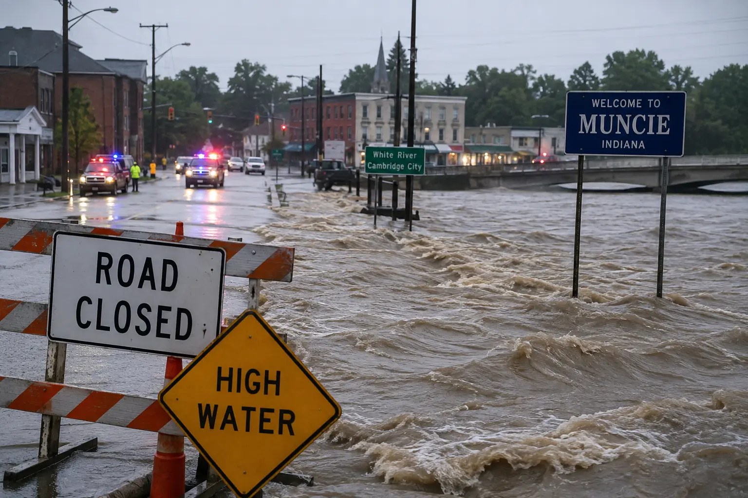

Latest: What began as a Flash Flood Emergency in Muncie and Cambridge City on August 12 has grown into one of Indiana's most destructive flood disasters in over a century. The White River broke records that had stood since the Great Flood of 1913 — 113 years — at multiple gauges as the crest moved downstream through Muncie, Anderson, Noblesville, and finally Indianapolis and Hamilton County. At Anderson, the river reached 24.93 feet, surpassing the previous 1913 record of 23.6 feet. In Indianapolis, the White River crested Saturday evening near 21.1 feet, prompting Mayor Joe Hogsett to order immediate evacuations in the Ravenswood, Rocky Ripple, and Broad Ripple neighborhoods, where the city sealed an engineered floodgate system and crews carried out dozens of boat rescues. At least six weather-related deaths have now been confirmed statewide by Indiana's Department of Homeland Security, including a 58-year-old woman found dead near her car on a flooded road in Yorktown. Gov. Mike Braun declared a statewide disaster emergency and requested a federal Presidential Emergency Declaration, which the White House has since signed, unlocking up to $5 million in initial federal assistance and clearing the way for individual FEMA aid once processed. More than 300,000 Hoosiers lost power at the peak of the event, and over 21 million people across the Midwest remained under flood watches into the weekend as additional rain moved through. Cambridge City and Wayne County, where the disaster began, are now shifting into the cleanup and recovery phase, while central Indiana communities along the White River are still working through active flooding.
A day after a deadly derecho and flash flooding tore through Ohio, the same relentless storm pattern rolled into Indiana on August 11-12, dropping what officials in Wayne County described as more than three months' worth of rain in about a day and a half in some spots. The result was catastrophic, fast-onset flooding that began in east-central Indiana and, over the following days, sent a wall of water moving downstream along the White River — breaking flood records that had held since 1913 and eventually reaching Indiana's capital.
Muncie and Delaware County: A Flood Beyond the 1913 Record
The National Weather Service issued a Flash Flood Emergency for Muncie, Yorktown, Chesterfield, and Albany just after 10 a.m. on August 12, after emergency management reported 3 to 6 inches of rain had already fallen in Muncie, with additional rainfall rates of 0.5 to 1.25 inches per hour. Muncie officials evacuated residents in the southeast part of the city as flooding worsened through the morning. By the next day, the White River at Muncie had reached major flood stage and crested at its highest level in more than 80 years. Muncie Mayor Dan Ridenour said the city received more rain in this single event than in any stretch since 1923, adding, "We have now exceeded the record floods that happened back in 1913." Delaware County also recorded a fatality connected to the flooding: a 58-year-old woman was found dead near her car on a flooded road in Yorktown, according to the Delaware County Sheriff's Office. Delaware County Emergency Management continues to ask residents to follow its social media for the latest on road conditions and shelters rather than relying on secondhand reports.
Cambridge City: Where the Disaster Began
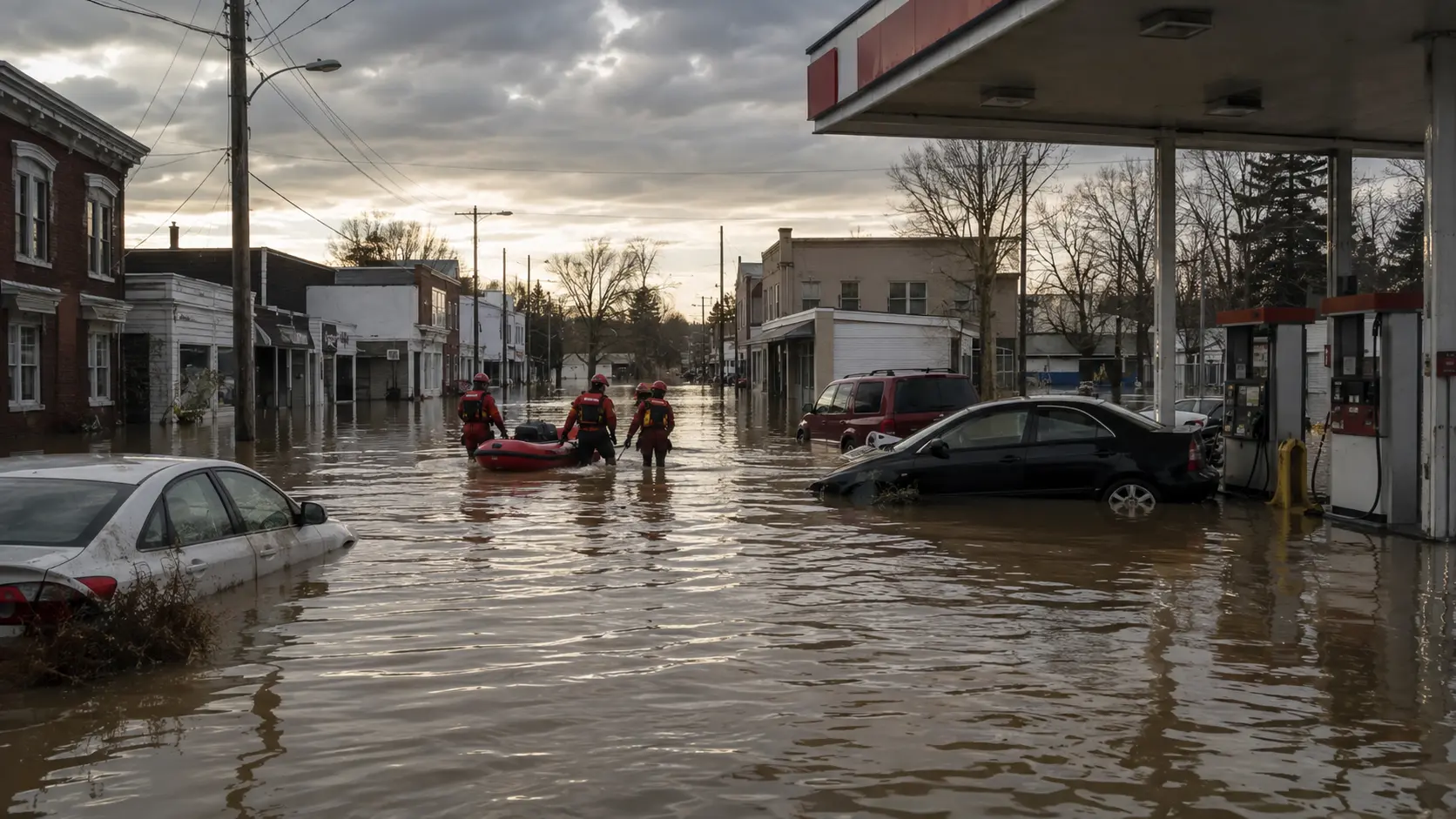
Wayne County took the worst of the earliest storms, with the Emergency Management Agency reporting between 7.3 and 10 inches of rain across the western part of the county in just 24 hours. Cambridge City, a small town about an hour east of Indianapolis that officials say is especially prone to flooding because of a canal running through it, saw a seven-to-eight-block residential area submerged by floodwater that rose well past the windows of homes and nearly to the roofs of parked vehicles. "When I looked out my window, I saw my fence floating past my window," resident Karlie Frey told WRTV after being evacuated by boat. Timothy Hicks, a father of six, described a panicked scramble to get his children out as water poured into their home: "I just started grabbing them, running them out to the car without even getting shoes, clothes or anything like that."
Wayne County Sheriff Randy Retter said rescue efforts stretched first responders to their limits given the sheer number of calls, with crews pulling residents from a roughly 15-square-block area of downtown Cambridge City alone — dozens of water rescues in total, including one man rescued after clinging to a light pole as muddy water rushed around him. At least 32 evacuees were relocated to a longer-term American Red Cross shelter at the Wayne County Fairgrounds. More than 2,000 Cambridge City residents lost power at the height of the storm, part of the more than 300,000 outages that peaked statewide, and the town operated under a boil-water advisory in the days that followed. Nearby Hagerstown was also significantly affected, with Turnpike Road washing away entirely. Wayne County has not reported any confirmed fatalities among its own residents; the storm's deaths have been recorded elsewhere across the state. Cambridge City is now moving into cleanup, with residents like neighborhood volunteer Miller telling reporters, "Don't ask us what we need, because we're still in shock. Just bring by dinner, bring diapers if they have babies, bring clothes."
Anderson, Noblesville, and Indianapolis: The Record Crest Moves Downstream
As floodwaters worked their way down the White River, the crest broke records at station after station. In Anderson, the river reached 24.93 feet — surpassing the 23.6-foot mark set during the Great Flood of 1913, long considered the second-deadliest flood in U.S. history. Anderson's mayor declared a local disaster emergency and ordered evacuations along the swollen river. In Noblesville, the White River set a new record as it reached major flood stage early Saturday morning with a crest above 24 feet, and the wall of water continued barreling toward suburban Indianapolis.
By Friday, Indianapolis Mayor Joe Hogsett had declared a local disaster emergency for Indianapolis and Marion County, placing the entire county under a travel advisory and ordering residents in Broad Ripple, Ravenswood, and Rocky Ripple to evacuate. The city's Department of Public Works sealed an engineered floodgate system around a residential zone in Broad Ripple bounded by North College Avenue, East 67th Street, Westfield Boulevard, and the White River, cutting off nine homes and the Edgewater Apartments from normal access. Rocky Ripple's levee, built in 1937 and standing about 17 feet tall, faced water levels expected to crest a foot above it — the worst flooding the town has seen since 1913. "Indianapolis is experiencing its most severe flooding in 30+ years. Conditions are shifting rapidly. Residents in Ravenswood, Rocky Ripple, and other impacted areas: please evacuate now," Hogsett said in a Saturday statement. The Indianapolis Fire Department carried out at least 38 rescues in the Ravenswood and Rocky Ripple areas Saturday morning alone, aided by two National Guard vehicles, and the city estimated roughly 400 people had been evacuated from Ravenswood by that point, with additional evacuations in Broad Ripple and in Carmel, including residents of an assisted living facility. The White River in Indianapolis was projected to crest near 21.1 feet Saturday evening, with flooding expected to expand south of downtown toward areas as far as Southport Road, and forecasters said the river was not expected to fall back below flood stage until early Tuesday.
Six Dead, Federal Disaster Declaration Now Approved
Indiana's Department of Homeland Security has confirmed six weather-related deaths connected to the week's storms and flooding, up from the five fatalities Gov. Braun cited at a Saturday press conference. Indiana DHS Executive Director Jonathan Whitham called it a historic event for the state, comparable to the major 2008 floods that had previously stood as a benchmark, and said damage has been reported "from corner to corner" of Indiana. Braun declared a statewide disaster emergency early in the event and deployed the Indiana National Guard, with 72 personnel activated alongside 48 Indiana Department of Natural Resources officers supporting water rescues and other response operations.
On Friday, Braun formally requested a Presidential Emergency Declaration from FEMA to unlock federal funding for emergency response costs, including water rescues, power restoration, and infrastructure repair. Braun said he spoke directly with President Trump, who indicated he intended to approve the request, and the White House has since signed the emergency disaster declaration, according to Sen. Todd Young. The approval makes up to $5 million in initial federal assistance available to support ongoing emergency response across the state; a broader Presidential Emergency Declaration is expected to follow, which would make individual FEMA assistance available to displaced residents through disasterassistance.gov. "Continue the response. Make sure life safety is our main priority. After that, we start the recovery process," Braun said. The governor's office is urging residents seeking shelter to call 211 and to contact their insurance providers as soon as possible.
Road Closures Across the Region
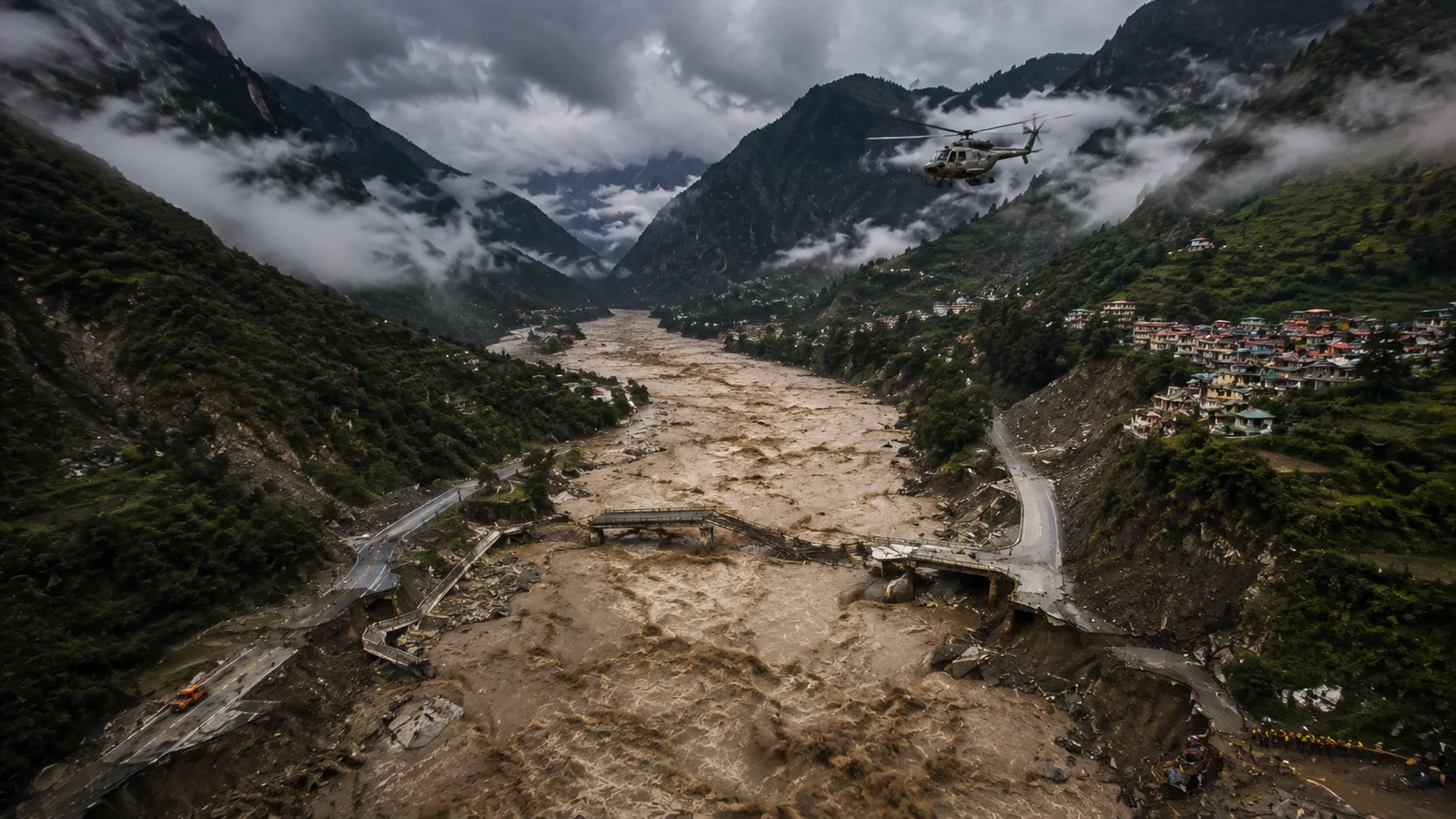
The flooding forced widespread road closures across multiple counties. In Wayne County, the westbound lanes of Interstate 70 washed away entirely just east of Centerville Road; INDOT says repair assessments will only begin once floodwaters recede, and drivers are being detoured via U.S. 27, U.S. 36, and State Road 9. State Road 38 remained closed west of U.S. 35 after part of the roadway washed away, and U.S. 40 was closed at Mulberry Street in Cambridge City. Eleven Indiana counties reported some form of travel advisory, watch, or warning tied to the flooding in the opening days of the disaster, and as the crest reached central Indiana, Marion County was placed under its own travel advisory covering the entire county. Check current county-by-county status before traveling, since advisories are still being adjusted as floodwaters recede in some areas and remain active in others.
- ✓Marion County / Indianapolis shelters: Red Cross–staffed Washington Township Adult Center, 8401 Westfield Blvd.; pet-friendly shelter at Broad Ripple Park Family Center, 1426 Broad Ripple Ave.
- ✓Wayne County shelter: American Red Cross emergency shelter at the First Bank Kuhlman Center, Wayne County Fairgrounds, 861 Salisbury Road N., Richmond.
- ✓Need help or shelter: Call 211 for assistance, and contact your insurance provider as soon as possible per the governor's office.
- ✓FEMA individual assistance: Not yet open. It becomes available once the full Presidential Emergency Declaration is processed; check disasterassistance.gov for updates.
- ✓Statewide travel status: Check in.gov/dhs/traveladvisory for current county-by-county travel advisories, still being updated as conditions shift.
- ✓Displaced pets: Wayne County Sheriff's Office is coordinating reunification for animals left behind during evacuations — residents can submit a request form via the Sheriff's Office social media pages.
Turn Around, Don't Drown: Officials across the state have repeatedly stressed that travel through flooded areas exposes drivers to serious risk of injury or death, and most flood deaths happen in vehicles — a warning underscored by the death of a Yorktown woman found near her car on a flooded road. Do not drive around barricades or "Road Closed" signs. In Indianapolis, officials warned that even residents who feel their home is safe should evacuate flood-prone neighborhoods like Ravenswood and Rocky Ripple immediately rather than wait, since conditions can shift within hours.
This flooding followed a destructive derecho and separate flash flooding that struck Ohio a day earlier, part of the same multiday severe weather pattern that moved across the Midwest and Ohio Valley. More than 21 million people remained under flood watches across the region into the weekend as additional rain fell on already-saturated ground. Indiana DHS Director Jonathan Whitham said the state should expect "a very extensive cleanup and recovery operation, almost statewide." This is a developing story; we'll continue updating it as county emergency management agencies, the National Weather Service, and state and federal officials release further information on the federal aid process, damage assessments, and recovery timelines.





Comments 0
No comments yet. Be the first to share your thoughts!
Leave a Comment