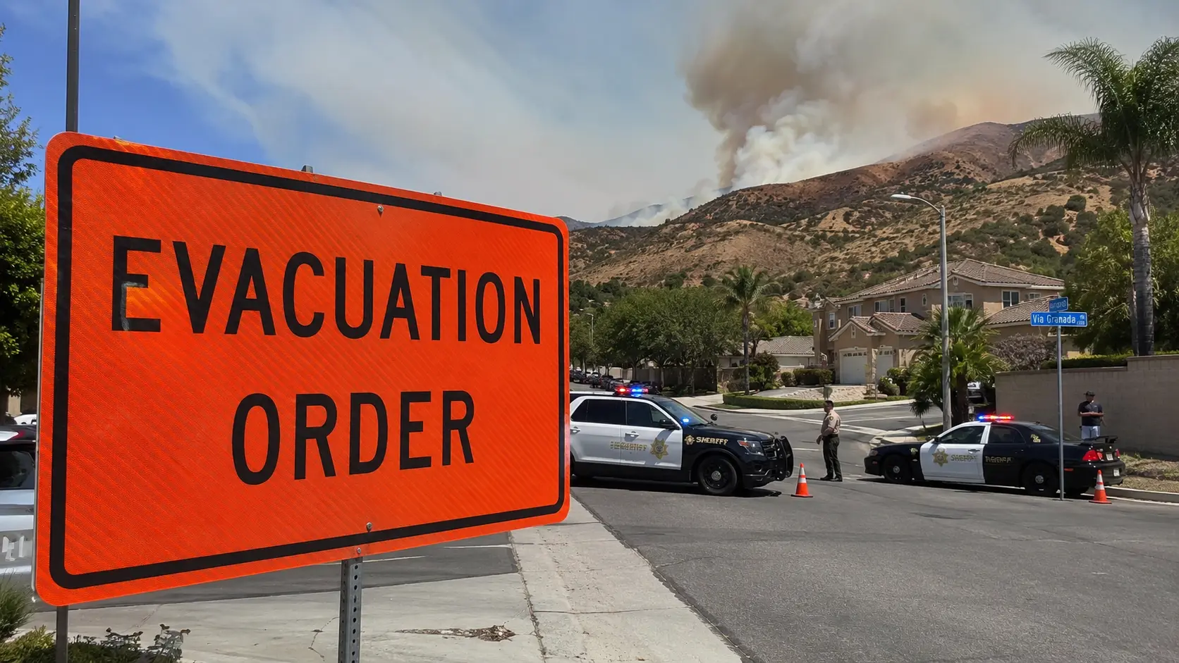

The people who survived the 2018 Camp Fire in Paradise, California, largely shared one characteristic: they left early. They did not wait for the Evacuation Order. They did not wait to see smoke or confirm that the fire was approaching. They saw the Warning — the less urgent advisory that means "be prepared to leave" — and they left. The people who waited for confirmation, waited to gather belongings, or waited because the fire seemed far away encountered a fire that reached town in under two hours from ignition and a road network that became a parking lot within minutes of the formal order.
Evacuation zone systems are designed to provide advance notice and staged response — giving people in different risk zones different levels of urgency based on their proximity and exposure. The system works when people respond to the appropriate level of urgency at each stage. It fails when everyone waits for the highest urgency level, which arrives when the window for safe departure has already closed for some zones.
In this article:
- The zone classification system
- How zones are assigned and changed in real time
- The Go Early principle
- Why evacuation warnings are routinely ignored
- Evacuation route design and bottleneck failures
- The Camp Fire: what the evacuation failure looked like
- Shelter-in-place for wildfire — when and when not
- Re-entry procedures
The Zone Classification System
The specific terminology varies by state and county, but the most widely adopted system uses three levels:
- Evacuation Warning (Level 1/Zone 1): A potential threat exists. Residents should be prepared to leave on short notice. Recommended action: voluntary evacuation for those with access needs, medical vulnerabilities, or animals/livestock requiring additional preparation time. The warning is issued when fire is in the area and conditions may deteriorate. Expected response: prepare to go, consider going now if any of the above apply to you.
- Evacuation Watch (Level 2/Zone 2, used in some jurisdictions): A probable threat — conditions are deteriorating and evacuation is likely to become mandatory. Recommended action: if you have not already left, leave now. This level may not be issued in all jurisdictions; some move directly from Warning to Order.
- Evacuation Order (Level 3/Zone 3): An immediate threat to life exists. Evacuation is mandatory. Residents remaining in the zone are at serious risk. Law enforcement may enforce the order and prevent re-entry. The Order is issued when the fire is advancing toward the area at a rate that makes remaining life-threatening within the order period.
California's statewide zone system, adopted as standard after the 2018 Camp Fire, uses numbered zones (Zone 1, Zone 2, Zone 3 corresponding to Warning, Watch, Order respectively) to reduce confusion from the varied terminology that different counties had used historically. Public messaging on the standardized system uses the consistent "Zone 1 = Get Ready, Zone 2 = Get Set, Zone 3 = Go" framework.
How Zones Are Assigned and Changed in Real Time
Zone assignments are made by the local emergency management agency in coordination with the incident management team managing the fire. The zone boundaries are geographic — they define specific addresses or geographic features — but they change as the fire develops. A neighborhood that is in Zone 1 at noon may be in Zone 3 by 3pm if fire behavior transitions from moderate to extreme under afternoon conditions.
The information that drives zone level decisions: fire location and direction of advance, rate of spread assessment from the incident management team, fire weather forecast (particularly wind direction changes), structural vulnerability of the threatened area, and road network capacity to support evacuation of the zone's population before the fire reaches the area.
Zone changes are communicated through multiple channels simultaneously: Wireless Emergency Alerts (WEA) to phones in the area, Nixle or similar local notification systems, social media from official accounts, local radio and television broadcasts, and law enforcement driving the neighborhoods with public address announcements. Not all channels reach all residents — the redundancy is intentional because no single channel achieves full coverage.
The Go Early Principle
Evacuation research from the 2017 and 2018 California fire seasons produced consistent data: residents who evacuated at the Warning level — before the fire was visibly close and before roads became congested — survived at dramatically higher rates than those who waited for the Order. The mechanism is simple: at Warning level, roads are clear, time is available, and conditions are manageable. At Order level, roads are congested or potentially compromised, time is short, and conditions are worsening.
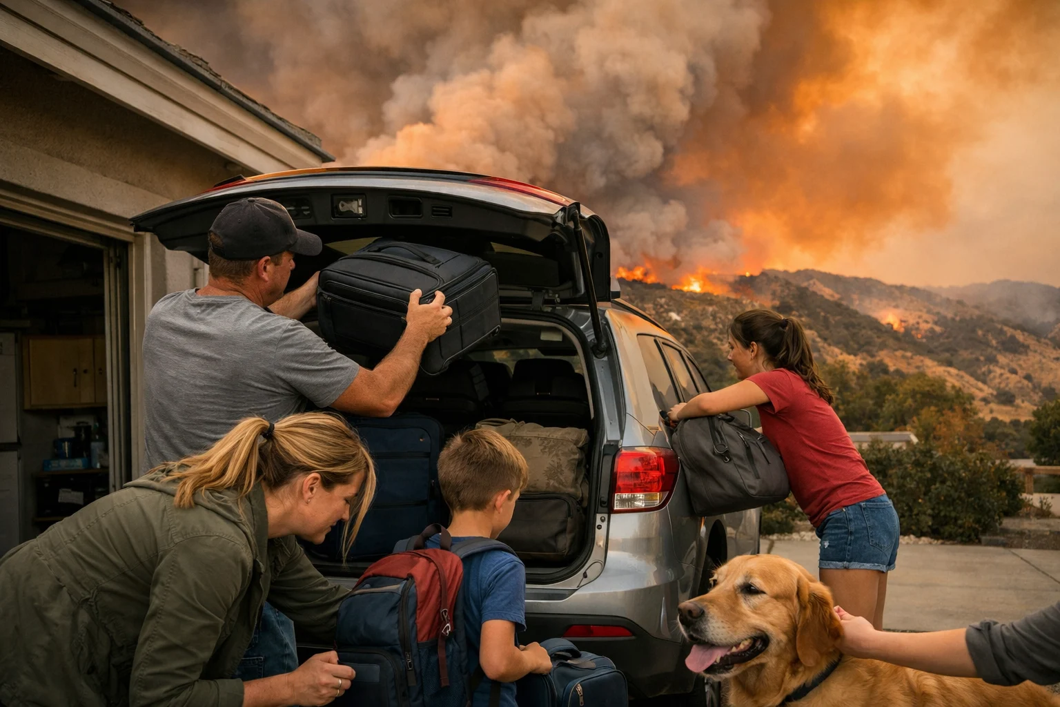
The Go Early principle formalizes this finding into a behavioral recommendation: when a Warning is issued for your zone, treat it as your evacuation trigger, not as a notification to monitor the situation. The Warning is issued when emergency management believes the fire may reach your area. The Order is issued when emergency management believes the fire will reach your area imminently. Waiting for certainty — the Order — means leaving in the worst conditions.
Go Early is particularly important for residents with access or functional needs: people who require assistance to evacuate, people with large animals or livestock that require significant loading time, people with medical equipment that requires careful packing, and people whose physical condition makes rapid departure difficult. For all of these populations, the Warning is the correct trigger. The Order is too late.
Why Evacuation Warnings Are Routinely Ignored

Studies of evacuation behavior in multiple wildfire events identify consistent reasons why residents ignore or delay response to Evacuation Warnings:
- Previous false alarms: Residents in fire-prone areas who have received multiple warnings that did not result in fire reaching their property develop "warning fatigue" — a tendency to discount new warnings based on past experience. Each uneventful warning reduces compliance with the next warning, even when the next warning is for a fire that will actually arrive.
- Disbelief and normalization: "It doesn't look that bad from my house" is a documented behavioral response to wildfire warnings. Smoke visible in the distance, without immediate visible threat, produces a cognitive underestimation of the fire's proximity and rate of spread.
- Attachment to property: The decision to leave a home permanently — or for an extended period — is not a simple cost-benefit calculation for most people. The reluctance to leave property, particularly property that cannot be fully secured, produces delay even when residents understand the risk.
- Incomplete information: Residents may receive a warning notification without understanding the specific zone they are in, the specific threat level the warning represents, or what action is expected of them at that level.
- Wanting to wait for family: Residents who are waiting for family members to return home before evacuating can be trapped by the rapid escalation from Warning to Order level if that escalation happens faster than expected.
Evacuation Route Design and Bottleneck Failures
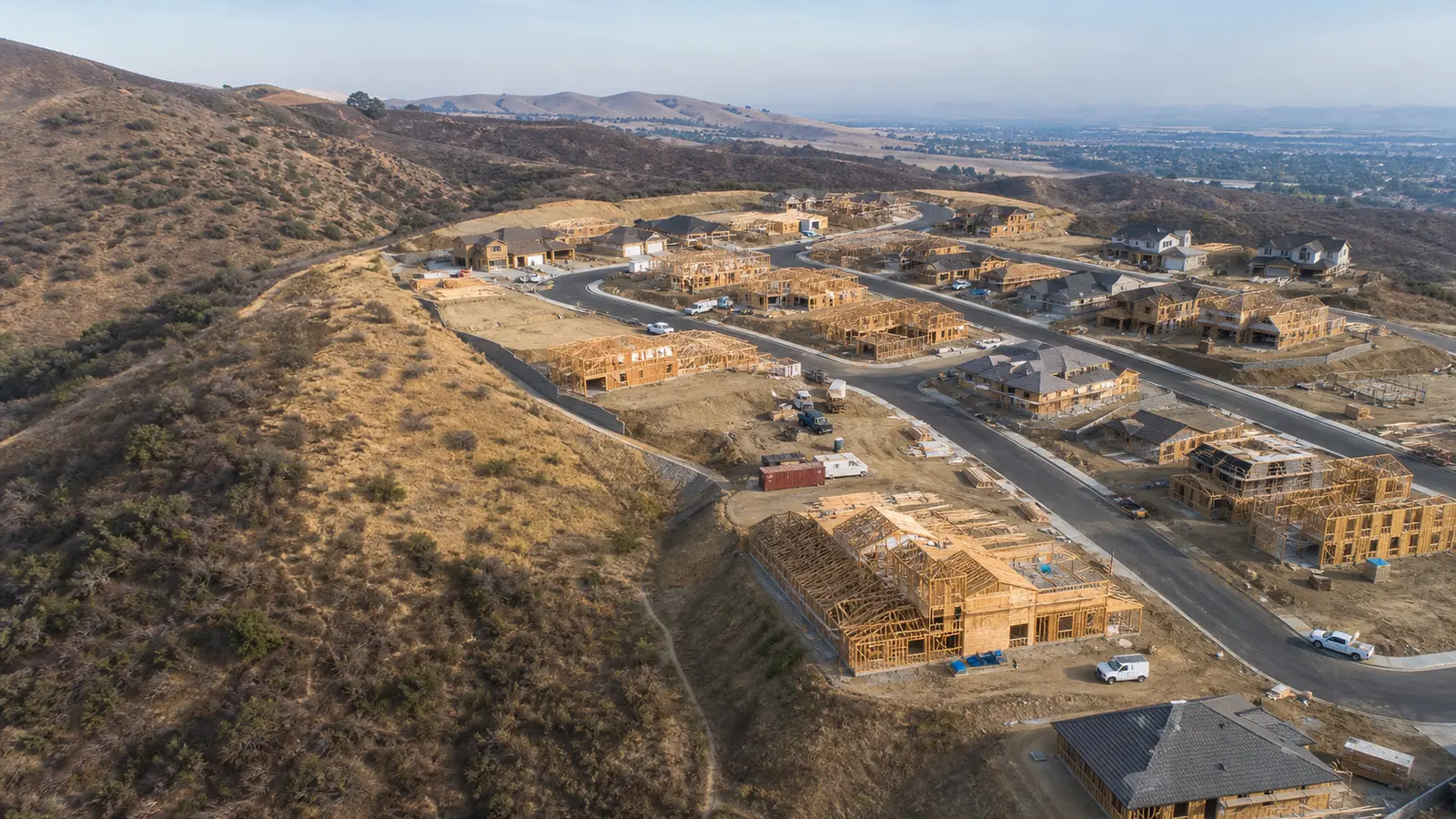
The effectiveness of an evacuation system is ultimately constrained by the road network that residents must use to leave. Many wildland-urban interface communities — particularly in California's foothill and mountain areas — were developed along single-access corridors: one road in and one road out, or at most two roads in opposite directions. When a fire is approaching from the primary egress direction, the secondary egress route may be inadequate for the community's population.
Road capacity and vehicle volume interact in a specific way during mass evacuation: a two-lane road with a capacity of approximately 1,500 vehicles per hour per direction becomes congested when community population exceeds what can be moved through that capacity in the available time. A community of 3,000 households attempting simultaneous departure through a road that handles 1,500 vehicles per hour requires two hours of clear road conditions — two hours that may not be available if the fire's rate of advance is faster.
Contraflow operations — reversing both lanes of a two-lane road for outbound traffic — approximately double evacuation capacity but require law enforcement to establish and maintain the contraflow before the operation can be used. Contraflow that is established after the main evacuation flow has begun requires stopping the existing evacuation stream, which creates a gap in departure that the advancing fire uses.
The Camp Fire: What the Evacuation Failure Looked Like
The November 8, 2018, Camp Fire ignited from a PG&E transmission line at approximately 6:15am. The first Evacuation Warning for Paradise was issued at approximately 7:57am — one hour and 42 minutes after ignition. The first Evacuation Order for Paradise was issued at approximately 8:00am — three minutes later, in a departure from the staged sequence that reflects how quickly the fire's rate of advance was assessed. The fire reached the town's southern edge within minutes of the Order issuance.
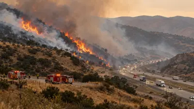
The result: massive simultaneous evacuation from a community of approximately 27,000 people through a road network designed for normal traffic, not mass emergency departure. Magalia Pines Road, Clark Road, and Skyway became immediately gridlocked. Residents abandoned vehicles in the road when they could not move. Some residents were overtaken by the fire while attempting to evacuate in vehicles that were stopped in traffic. The 85 fatalities included people in vehicles on evacuation routes.
Post-incident analysis identified several factors: the warning lead time was insufficient for the population size given the road network capacity, the staged Warning-to-Order system collapsed into a near-simultaneous notification because the fire developed faster than the staged timeline assumed, and the community's road network had a single primary egress corridor inadequate for simultaneous departure of the full population.
The Camp Fire produced significant changes to California's evacuation planning requirements: mandatory community evacuation plans with road network capacity analysis, standardized zone systems, pre-positioned notifications to enable earlier Warning issuance at lower fire probability thresholds, and specific requirements for communities with limited egress routes to develop staged departure plans that sequence different zones at different times rather than triggering simultaneous departure.
Shelter-in-Place for Wildfire — When and When Not
Shelter-in-place — remaining inside a building rather than attempting evacuation — is appropriate for some hazmat scenarios (covered in the chlorine gas article elsewhere on this site) but is generally not recommended as a primary strategy for wildfire, for a specific reason: a building is not a protection against a wildfire that reaches it and ignites the structure. Sheltering inside a burning building is not a survivable option.
The limited scenario where last-resort shelter in a building may be considered: a resident who is caught by a rapidly advancing fire while attempting to evacuate and cannot safely continue to drive — if a building is available that has concrete or masonry construction, no visible fire involvement, and the fire front appears to be passing quickly through the area. This is a last resort, not a planned strategy, and it requires specific building characteristics that most residences do not have.
Shelter in a vehicle during a wildfire, when caught by a rapidly moving fire while driving, has a different protocol: pull to the side of the road away from vegetation, turn off the engine, get on the floor, cover with a blanket if available, stay low and below the smoke level in the vehicle, and wait for the main fire front to pass. Vehicles provide limited but real protection from radiant heat for the brief period (typically 1 to 3 minutes) that a fire front passes a specific location.
Re-Entry Procedures
Re-entry to an evacuated zone after a wildfire is controlled by the same emergency management system that issued the evacuation orders. Re-entry is not permitted until: the fire threat has passed or is controlled, utility systems have been assessed for safety (gas line integrity, electrical line damage), structural assessments have been completed for high-risk areas, and road conditions are safe for civilian vehicle traffic.
Re-entry is typically staged — emergency personnel first, then residents with critical needs (livestock care, essential medication retrieval), then general re-entry. Different zones may open at different times depending on their fire exposure and damage level. A Zone 1 area that received a Warning but never an Order may open for re-entry before a Zone 3 area that experienced direct fire impact.
Re-entry checkpoints are staffed by law enforcement who verify residency — typically through driver's license or property documentation — before allowing passage. Looters have been documented entering evacuated areas during wildfire events, and the re-entry control system is designed to prevent this as well as to prevent residents from returning to unsafe conditions.


Comments 0
No comments yet. Be the first to share your thoughts!
Leave a Comment