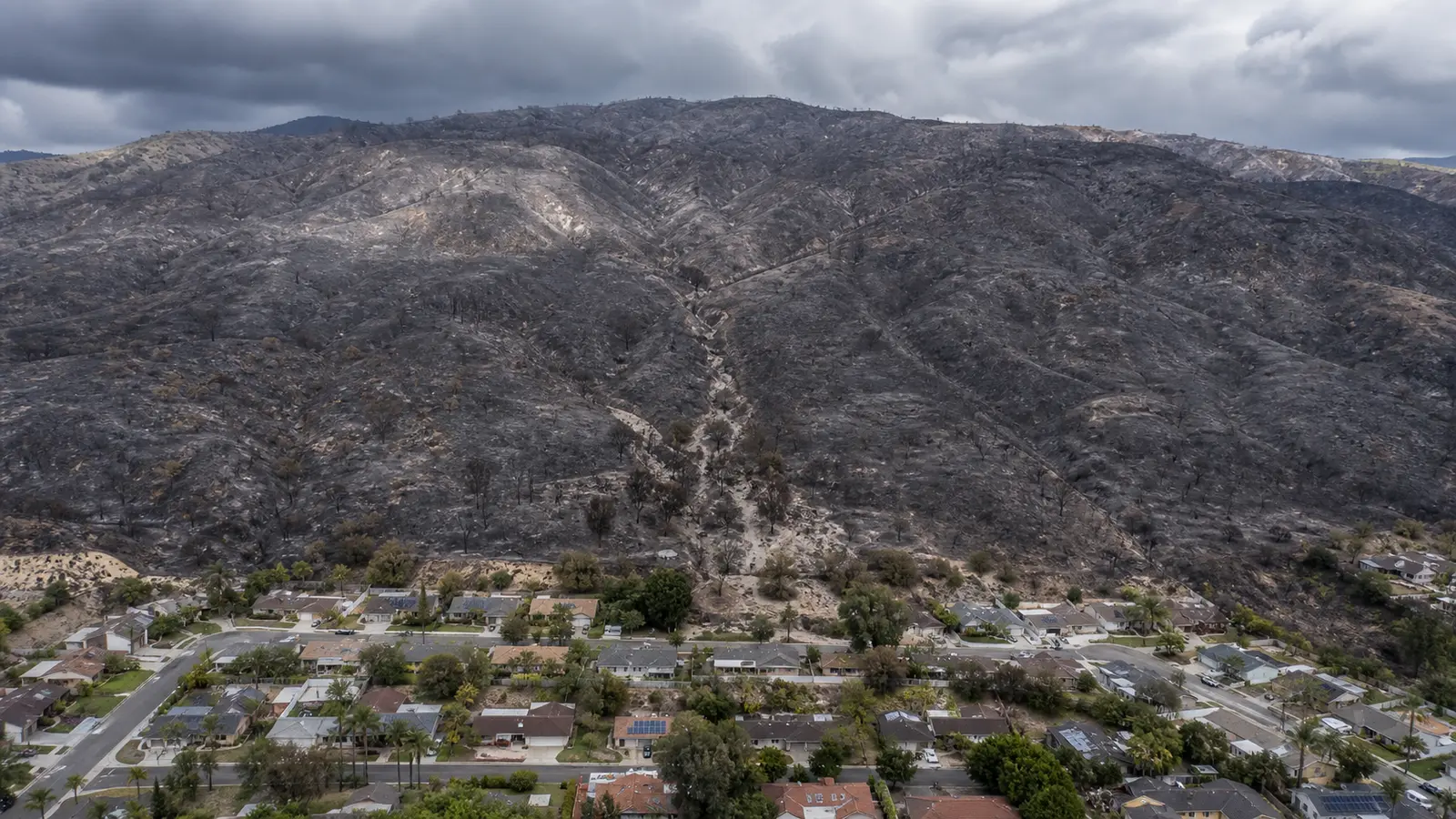

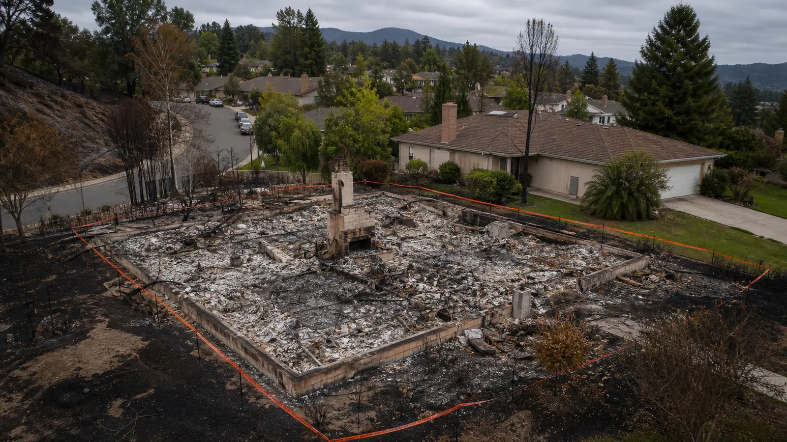
On January 9, 2018, five months after the Thomas Fire burned 281,893 acres across Ventura and Santa Barbara counties, a debris flow swept through the community of Montecito in the early morning darkness. Twenty-three people died. More than 100 homes were destroyed. The flow — a fast-moving slurry of mud, boulders, and destroyed vegetation — traveled downslope so fast that many residents who had been told they could shelter in place had no time to respond. The warning time between rainfall onset and debris flow impact was measured in minutes.
The Montecito debris flow is the clearest large-scale demonstration of a dynamic that fire departments in wildland-urban interface communities have been managing for years: wildfire doesn't end when the fire is out. It creates conditions that make burned hillsides catastrophically vulnerable to post-fire debris flows and mudslides for months to years after the last flame is extinguished. In areas where the 2026 fire season is burning aggressively — and where significant rainfall is still months away — the post-fire hazard window is opening even as the fire season itself continues.
In this article:
- Why burned hillsides become debris flow hazards
- Hydrophobic soil — what fire does to the ground
- How fast debris flows move — and what they carry
- The post-fire risk window: how long it lasts
- Rainfall thresholds and warning systems
- What fire departments do in post-fire debris flow response
- If you live below a burned slope: what to do before the rain comes
Why Burned Hillsides Become Debris Flow Hazards
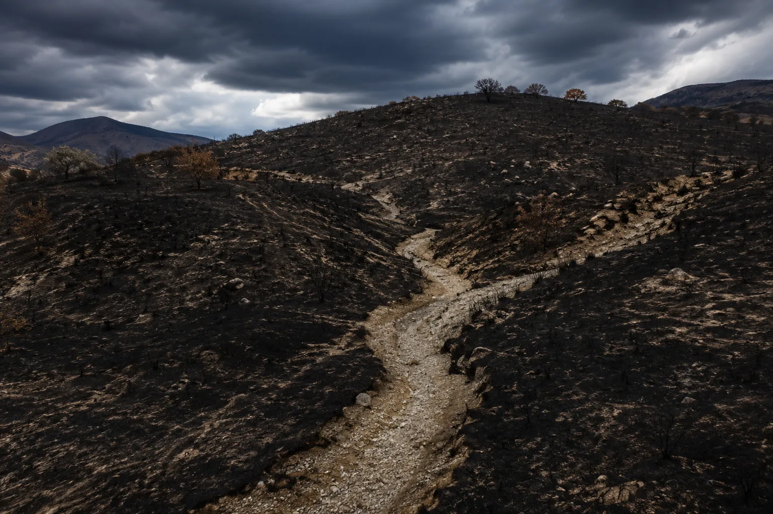
A hillside in its natural vegetated state manages rainfall through a combination of interception, absorption, and root-anchored soil stability. The plant canopy intercepts rainfall before it reaches the ground, reducing its kinetic impact on soil. Plant roots bind soil particles and create a network of channels that allow water to infiltrate rather than run off the surface. Organic material in the soil acts as a sponge, absorbing and releasing moisture gradually.
A wildfire removes all of this simultaneously. The canopy is gone — rainfall impacts bare soil directly. The roots are dead and begin to decompose, releasing the binding that held soil particles in place. The organic material is burned, reducing the soil's moisture retention capacity. And — critically — the combustion of organic material in and on the soil produces a layer of hydrophobic compounds that seal the soil surface, preventing rainfall from infiltrating at all.
The result is a hillside that converts rainfall into surface runoff almost immediately, with no root structure to hold soil in place as the water moves, and with a surface sealed against infiltration that concentrates water into channels and drainage paths. When rainfall intensity exceeds the infiltration capacity of a burned slope — which can happen at intensities as low as half an inch per hour on severely burned terrain — the water and soil move downslope together as debris flow.
Hydrophobic Soil — What Fire Does to the Ground
Soil hydrophobicity is the most important fire-induced ground change for understanding post-fire debris flow risk. As organic material burns at the soil surface, gases driven downward by heat condense on cooler soil particles below the surface, coating them with hydrophobic compounds — substances that repel water rather than absorbing it. This hydrophobic layer typically forms one to four inches below the surface, at the depth where soil temperatures during the fire were high enough to vaporize organics but not hot enough to fully combust them.
The consequence is dramatic: on a severely burned slope, water applied to the surface — including rain — does not infiltrate. It beads and sheets off as if the soil were a tilted roof. At low rainfall rates, this runoff is manageable. At intensities that would be routine on unburned terrain, it produces overland flow that picks up the loose ash and unbound soil particles above the hydrophobic layer and carries them downslope.
Hydrophobicity intensity varies with fire severity. High-severity burns that fully combust surface vegetation and heat the soil deeply produce more pronounced and more persistent hydrophobic layers than low-severity burns that leave significant organic material intact. Post-fire burn severity maps — produced by USGS and the Forest Service using satellite imagery — are the primary tool for identifying which burned hillsides carry the highest debris flow risk.
How Fast Debris Flows Move — and What They Carry
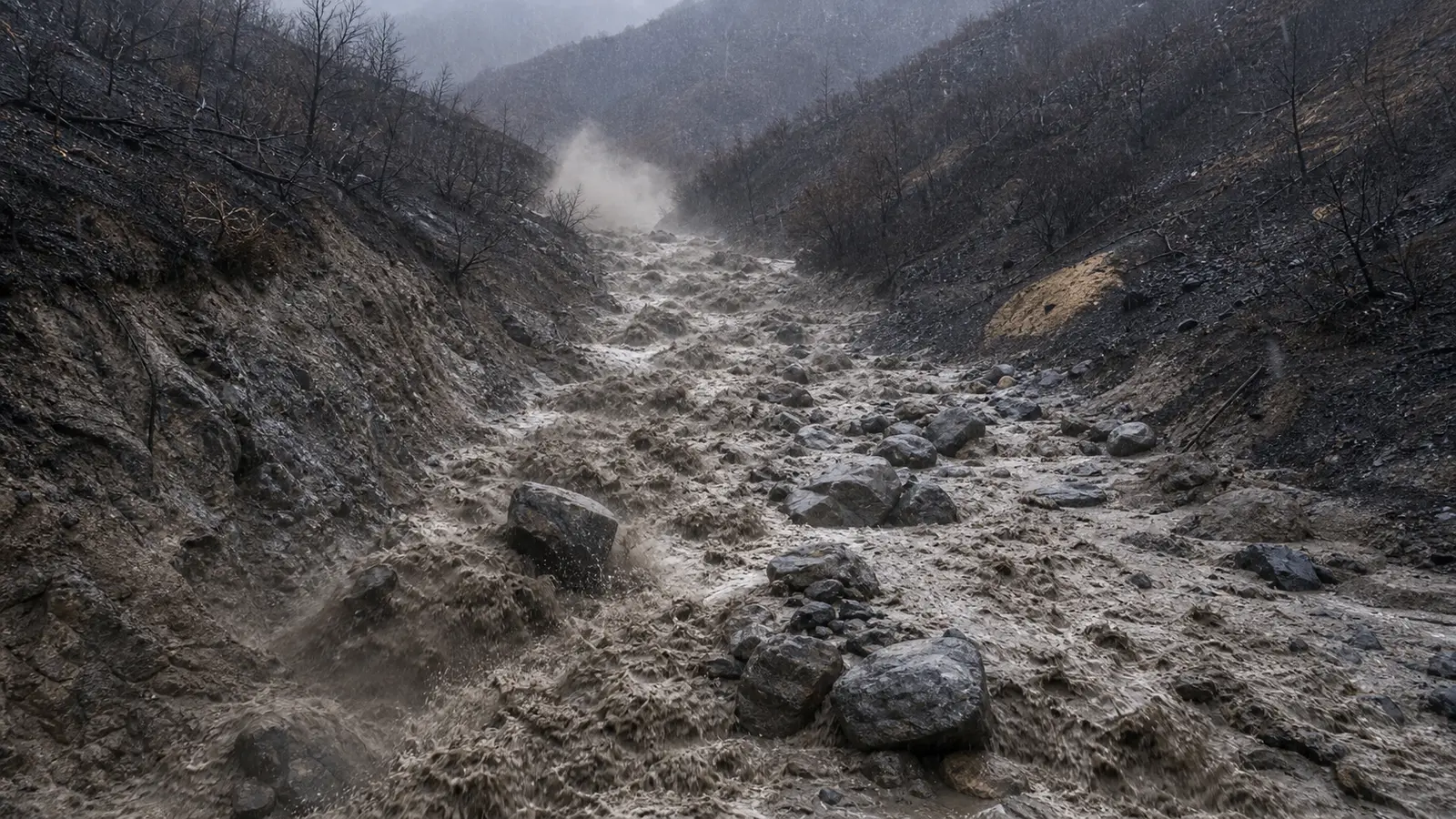
Post-fire debris flows are fundamentally different from mudslides in gradual terrain. They are not slow-moving creep events that allow time for people on foot to move out of the way. In the canyon and drainage geometry typical of burned California hillsides, debris flows move at speeds ranging from 10 to 35 miles per hour. The Montecito flow in 2018 was estimated at approximately 20 mph through the canyon — faster than most people can run on open terrain, and far faster than anyone can move through a house with furniture and debris impeding movement.
The flow's composition is what makes it lethal at those speeds. Unlike pure water, a debris flow contains entrained soil, rocks, boulders, burned tree trunks, fence posts, and structural debris from any structures it passes through. The density of the slurry means it carries objects with far more force than water at the same velocity — a flow that would be survivable if it were water becomes unsurvivable when it is carrying half-ton boulders at highway speeds through residential terrain.
The front of a debris flow is its most dangerous element. The initial surge carries the highest concentration of coarse debris — boulders and large woody material — that it has been collecting as it traveled downslope. This frontal surge impacts structures before the main flow body arrives, which means structural damage from boulders may precede the mud inundation by seconds. In Montecito, many victims were found in the mud fill of their homes — not in the path of the flow outside — because the boulders and debris compromised the structure before the flow entered.
The Post-Fire Risk Window: How Long It Lasts
Post-fire debris flow risk is highest in the first rain season after a fire — the first autumn and winter of significant precipitation following a summer fire. This is when burned slopes first encounter the rainfall that tests the hydrophobic layer and erodes the unbound ash and soil. But the risk does not disappear after the first rain season.
Root decay continues for two to three years after a fire, progressively reducing the anchoring of soil on steep slopes. As roots decompose, areas that survived the first rain season without major failure may become unstable in subsequent years. Vegetation recovery partially restores slope stability over three to five years, but the recovery rate depends on the burn severity, the rainfall pattern, and whether invasive species colonize the slope before native vegetation can re-establish.
USGS and NOAA produce post-fire debris flow hazard assessments for major fires that quantify the probability and potential magnitude of debris flows at specific rainfall intensities. These assessments are public and are the primary tool used by county OES offices to establish post-fire evacuation zones ahead of rain events. Residents in burned watersheds should check whether their area is covered by one of these assessments and what their specific hazard probability is at different rainfall thresholds.
Rainfall Thresholds and Warning Systems
The threshold concept is central to post-fire debris flow management. For a given burned watershed, researchers and emergency managers establish the rainfall intensity and duration that is likely to produce a debris flow — for example, 0.5 inches per hour for 15 minutes, or 1 inch in 30 minutes. Below the threshold, rain falls and the slope holds. Above it, the probability of debris flow initiation increases sharply.
NOAA and the National Weather Service, in coordination with USGS, operate a system of rain gauges in burned areas and issue debris flow watches and warnings when rainfall rates are approaching or exceeding hazard thresholds. These warnings are broadcast through the same WEA system as other emergency alerts and through county opt-in notification systems.
The critical difference from standard flood warnings: the response time is much shorter. A standard flood watch may give communities hours to respond. A debris flow that initiates at a threshold-crossing rainfall event can travel from the head of a canyon to a residential area in minutes. The pre-event warning — issued before rain reaches the threshold — is the action trigger. Residents who wait for a debris flow warning after they see or hear the flow have missed their evacuation window.
What Fire Departments Do in Post-Fire Debris Flow Response
Post-fire debris flow response is a technical rescue discipline that combines structural collapse rescue, swift water rescue, and mass casualty incident management. It is one of the most challenging operational environments in the fire service — crews are working in unstable terrain, in darkness, in moving mud that can trap responding vehicles and personnel, with victims who may be buried under debris that continues shifting as rain continues falling.
Departments in high-risk post-fire areas pre-stage resources before threshold rainfall is forecast — not after. Swiftwater rescue teams, technical rescue resources, and mutual aid agreements with adjacent departments are activated during the watch period so that response capacity is in place when the flow occurs, not being dispatched after it. The Montecito response required mutual aid from across Santa Barbara, Ventura, and Los Angeles counties because the initial debris field was so large that local resources were overwhelmed within the first operational period.
Crew safety in post-fire debris flow environments requires constant reassessment of secondary flow risk. Rescue operations on a debris field can be overtaken by subsequent flows from the same watershed if rainfall continues. Incident commanders managing post-fire debris flow rescues balance the urgency of victim extraction against the real risk that continuing rain produces a second flow that traps rescuers alongside the original victims. This is the same decision framework as wildfire structure defense, with the same fundamental principle: life safety for responders is non-negotiable, even when victims are confirmed alive.
If You Live Below a Burned Slope: What to Do Before the Rain Comes
- ✓Check the USGS post-fire debris flow hazard assessment for your watershed. Search "USGS post-fire debris flow [fire name]" — assessments are produced for major fires and show probability maps at different rainfall intensities. Know whether your property is in a high, moderate, or low probability zone and what the triggering rainfall threshold is.
- ✓Register for county emergency alerts at your current address. Post-fire debris flow warnings come through the same county opt-in notification systems as wildfire alerts. If you're not registered, you may not receive the pre-event warning that is your only realistic action trigger.
- ✓Know your upslope drainage paths. Debris flows follow drainages. Identify which canyons, creeks, and channels upslope of your property would route a flow toward or through your location. The flow travels the path of least resistance — the same path stormwater takes.
- ✓Treat a debris flow watch like a wildfire warning — begin preparation immediately. When a debris flow watch is issued for your watershed, begin departure preparation. Consolidate documents, medications, and pets. Identify your evacuation route and confirm it doesn't pass through a drainage that could be flowing. Have the vehicle ready to move.
- ✗Do not shelter in the lower floors or basement of a home downslope of a burned watershed during a debris flow warning. If a flow arrives, it will enter the structure at ground level first. Upper floors provide survival time — lower floors do not. The Montecito survivors who sheltered in upper floors of intact structures survived. Those in ground-floor rooms and lower-lying areas had far lower survival rates.
The 2026 fire season is burning aggressively across terrain that will face its first significant rainfall in autumn. Every acre burned this summer on steep terrain above a populated drainage is a future debris flow hazard that will be activated by the first significant storm of the rainy season.
The fire service lesson from Montecito is the same as from every fast-moving wildfire: the people who left early based on the watch survived well. The people who waited for confirmation of the actual flow had seconds to minutes to respond inside a house that was already in the flow path. Post-fire debris flow risk is not a consequence of bad luck. It is a predictable, mappable, forecastable hazard that rewards preparation and punishes hesitation as severely as any fire event does.




Comments 0
No comments yet. Be the first to share your thoughts!
Leave a Comment